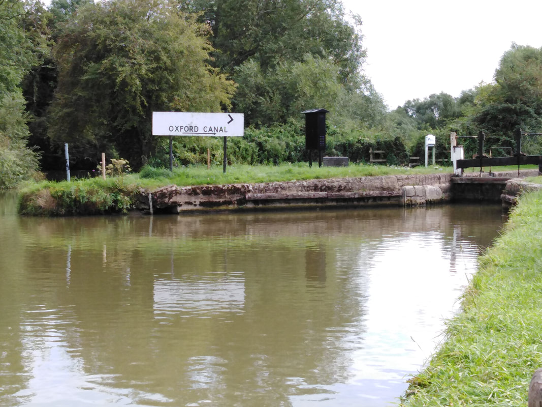
We begin our journey at the point where the Oxford canal and the river Cherwell part company.
In an effort to reduce costs and speed-up construction of the canal, sections of the river Cherwell were used as part of the the canal route.
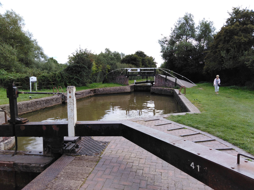
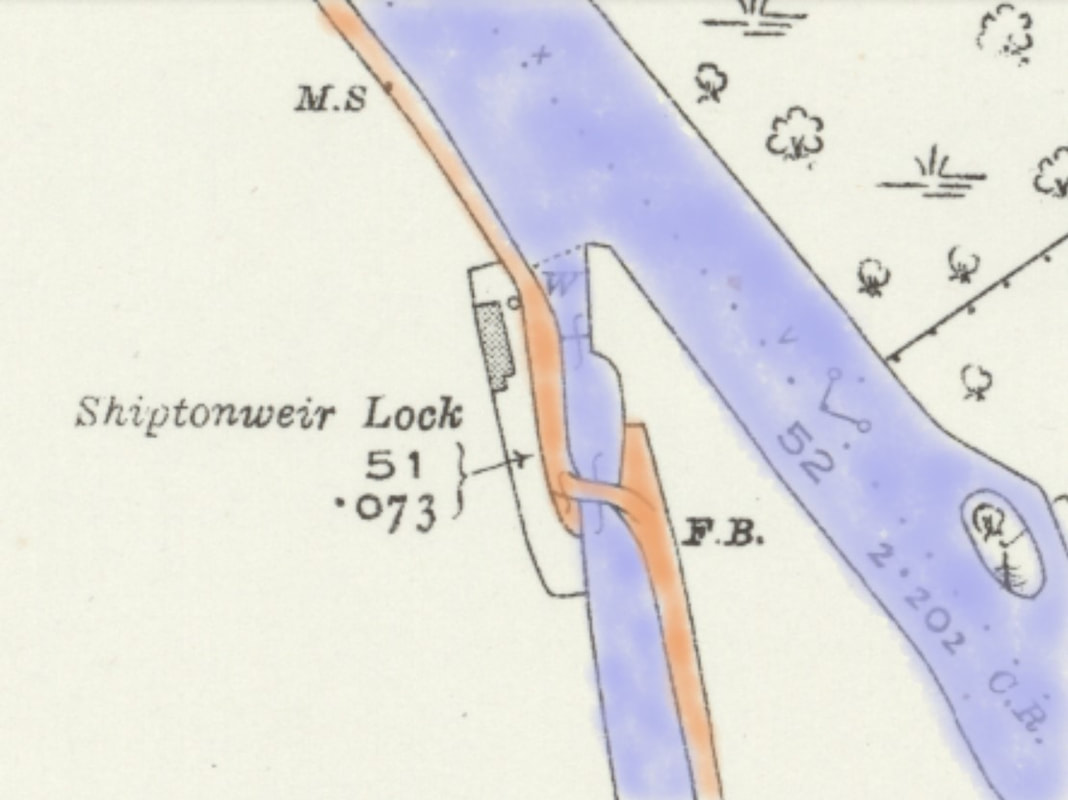
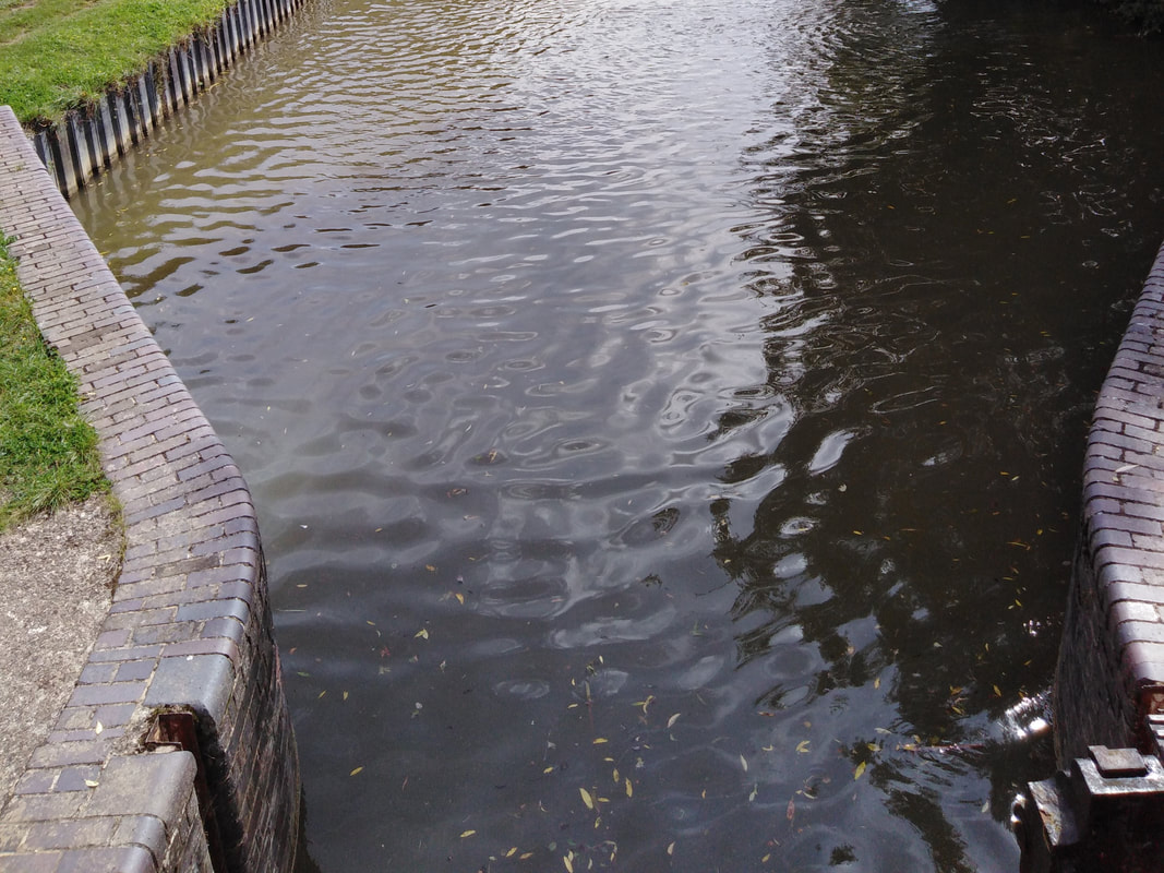
Boats leaving the river and entering the canal do so via Shipton Weir Lock (Lock 41).
This lock is unusual because it is between a river and a canal and has a number of interesting structural features.
In an effort to reduce costs and speed-up construction of the canal, sections of the river Cherwell were used as part of the the canal route.
Boats leaving the river and entering the canal do so via Shipton Weir Lock (Lock 41).
This lock is unusual because it is between a river and a canal and has a number of interesting structural features.
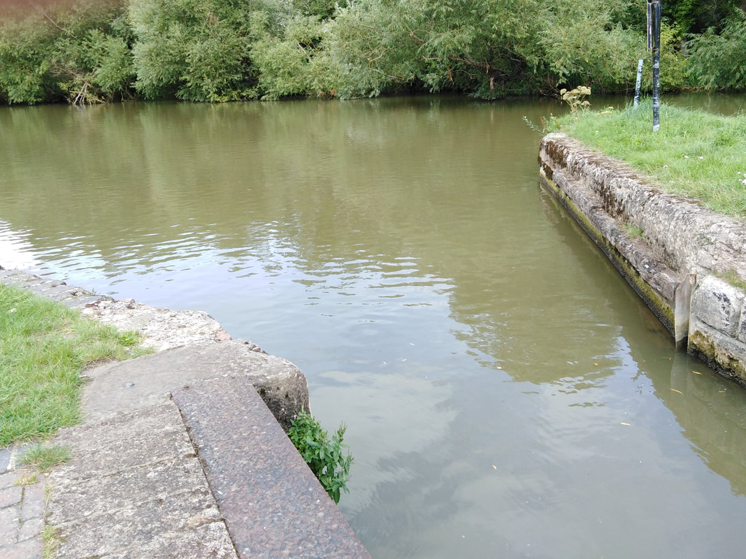
The difference in water height between the Cherwell and the canal is small, averaging just 2 ft 5 ins (74 cm). This can vary considerably, and the lock protects the canal from seasonal changes in the river flow and height.
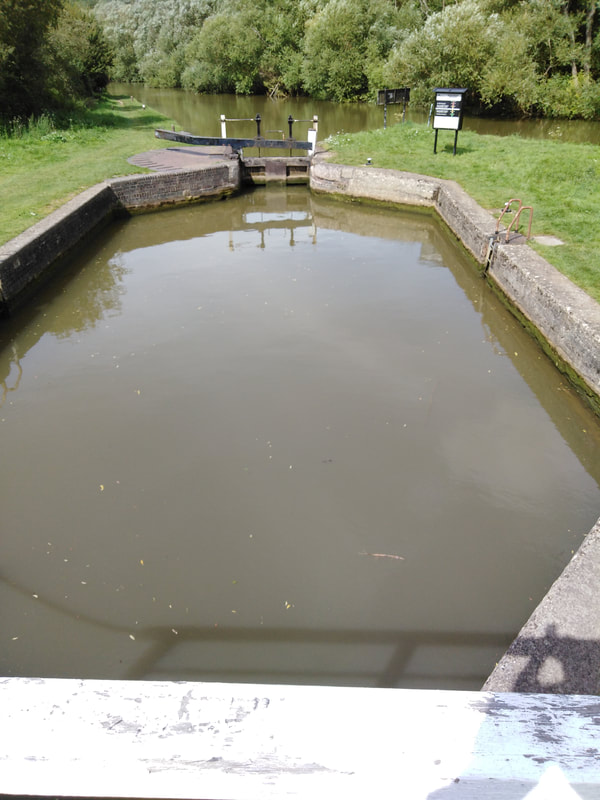
Because the change in height through the lock is small, maintaining the forward volume of flow into the canal every time the lock is opened can be a problem. This has been solved by building a wide lock with an unusual six sided "lozenge" shape. This increases the volume of the lock chamber, and thus the amount of water that flows into the canal every time the lower lock gate is opened.
Because the change in height through the lock is small, maintaining the forward volume of flow into the canal every time the lock is opened can be a problem. This has been solved by building a wide lock with an unusual six sided "lozenge" shape. This increases the volume of the lock chamber, and thus the amount of water that flows into the canal every time the lower lock gate is opened.
25 inch to the mile maps from the early 1900's show the lock layout almost as it appears today. The major difference is the presence of a lock keepers house to the west of the lock. The restricted width of the towpath between the lock and the house meant that the balance beam on the river lock gate had to be cranked (set at an angle) to allow free passage around it. The house was built in 1851 and occupied until after World War II, and then lay derelict for several years before it was demolished.
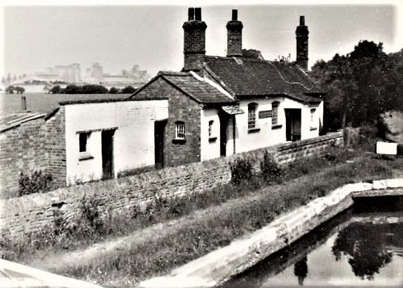
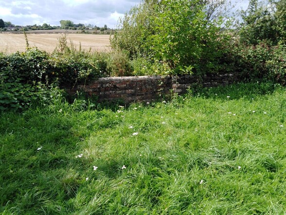
Part of the lock keepers house garden wall facing onto the towpath still survive, but no sign of the house itself are visible - the site being covered with scrub.
Much of the brickwork of the lock chamber that we see today is restoration, but several original features still exist.
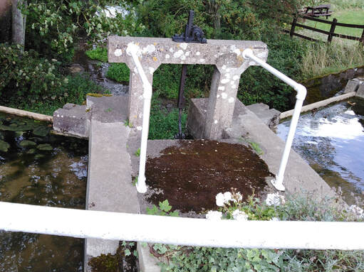
At both ends of the lock, beyond the lock gates, are vertical slots set into the brick work. These are "stop plank" slots into which planks can be lowered until the combined height of the planks is above the water, allowing a section of canal or lock to be isolated. The section can then be drained for repair or maintenance.
At both ends of the lock, beyond the lock gates, are vertical slots set into the brick work. These are "stop plank" slots into which planks can be lowered until the combined height of the planks is above the water, allowing a section of canal or lock to be isolated. The section can then be drained for repair or maintenance.
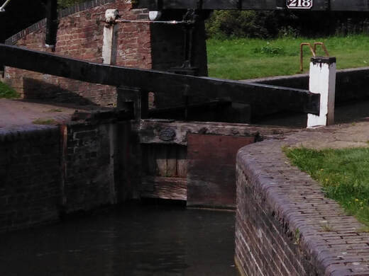 Southern lock gate with paddle gear.
The lock gates are single, and both upper and lower gates have gate paddles which allow water to enter or exit the lock chamber. These paddles are opened or closed by gate paddle gear and a rack which is operated by a hand wound windlass.
The ladders recessed into the sides of the lock chamber are later additions. These were only added as standard safety features on all locks, after a number of drownings when the victims could not escape from the vertical walled lock chamber.
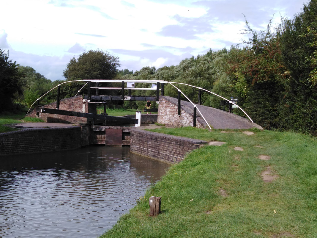
Spanning the southern (canal) end of the lock is bridge 218. This is a so-called "turnover bridge", taking the towpath from one side of the canal to the other.
The bridge is Grade II listed and has an original S-plan layout, with much surviving brickwork (apart from the darker bricks used to restore the bridge walkway). The iron railings are original, but all the wooden posts and central spanning wooden walkway are restoration.
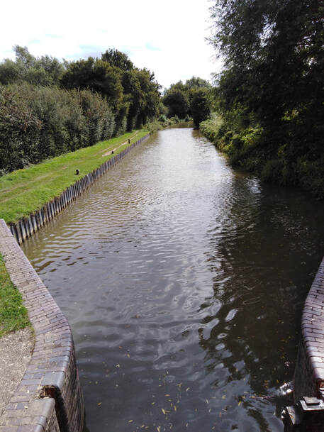
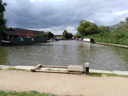
To the south of the lock, the canal widens and a straight section runs towards Shipton on Cherwell.
Along the near-side are a number of wooden mooring posts. These are unlikely to be original, but such mooring posts would have been present during the "working" days of the canal.
Along the edge of the canal at this point, is a length of galvanised steel piling (edging). Canal edges are constantly under threat of wear and tear, and this is especially true in more recent times due to the increased turbulence from powered craft. Steel piling has become a common method of canal edge repair, but can be somewhat out of keeping with the overall appearance of the the canal setting.
There are a number of methods of repairing and strengthening towpath edges, and we will see some of these further down the canal.
The canal continues south and turns gradually westwards.
The nearside is bounded by thick hedging with occasional gaps, which give glimpses of the low lying Cherwell flood plain with the river beyond. The off-side is far more open allowing views across open farmland as it slopes gently towards the canal and river Cherwell.
The nearside is bounded by thick hedging with occasional gaps, which give glimpses of the low lying Cherwell flood plain with the river beyond. The off-side is far more open allowing views across open farmland as it slopes gently towards the canal and river Cherwell.
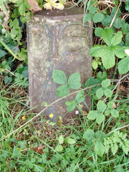
About 100 yards (91 m) beyond the lock is a canal distance marker. This consists of a hollow cast iron post, about 30 cm high, with a triangular section and open back. On the front are the embossed letters DIS. They are often painted white, with the lettering picked out in black. These are thought to be of nineteenth century origin and the lettering is an abbreviation for DISTANCE. Although the transport of heavy materials, especially coal in dedicated coal boats, was the primary trade on the canal, a number of other craft plied their trade. These included smaller boats carrying salt, roadstone, iron and manufactured goods.
"Fly boats" operated to set timetables between certain points , with limited stopping points, and could claim priority at locks once they passed the DIS post (how they did this is unclear). They frequently ran for 24 hours a day and provided the fasted means of transporting goods before the arrival of the railways.
Market boats in contrast, stopped at every wharf along their route, and carried a mixture of passengers, livestock and goods.
A short distance further on we approach the Shipton Lift Bridge (No. 219). The bridge is of a type which is almost unique to the Oxford canal. Lift Bridges were used on the southern section of the Oxford canal to reduce costs, after financial constraints threatened to delay, or even stop, completion of the canal. Of the 133 bridges between Napton Junction (where the Oxford canal and the Grand Union canal meet) and Oxford, 20 are lift bridges and there are the bases or sites of 5 others which have been dismantled or replaced by fixed bridges.
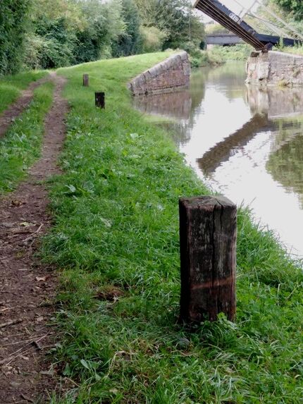
The approach to Shipton Lift Bridge (No. 219) showing mooring posts.
The narrowing in the canal width to reduce the length of the lift bridge section is clearly seen.
Typically these lift bridges were used as "accommodation bridges" on minor byways, maintaining an existing right of way, which had been interrupted by the canal. These were often for farmers, whose grazing and/or fields had been separated, or where an existing pathway/track was crossed by the canal. Where a more substantial road was cut by the canal, a fixed stone or brick bridge was often built.
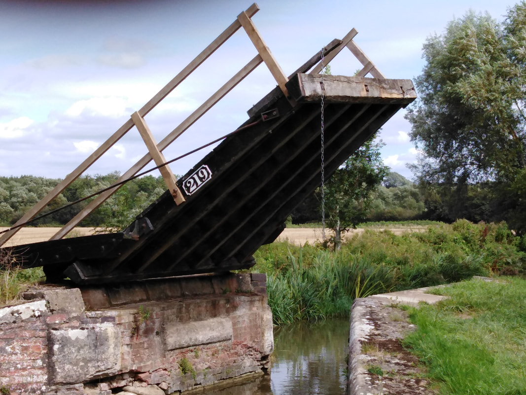
The bridge, which is Grade II listed, retains many original features with some later repairs and alterations (mainly to the timber components). It consists of a tilting wooden plank deck with wooden hand rails and two balance beams set at a raking angle.
The bridge normally sits in the raised position, to allow the uninterrupted passage of canal boats, and is lowered by pulling on the attached chain or by walking onto the deck if approaching from the off-side.
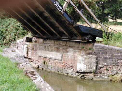
The bridge sits on a raised base (abutment) which protrudes into the canal. It is faced with original 18th century brickwork and large stone rubbing blocks, which project above the brickwork faces. These rubbing blocks are made of a stone which is far harder than the surrounding brickwork and protect the brickwork from damage by passing boats.
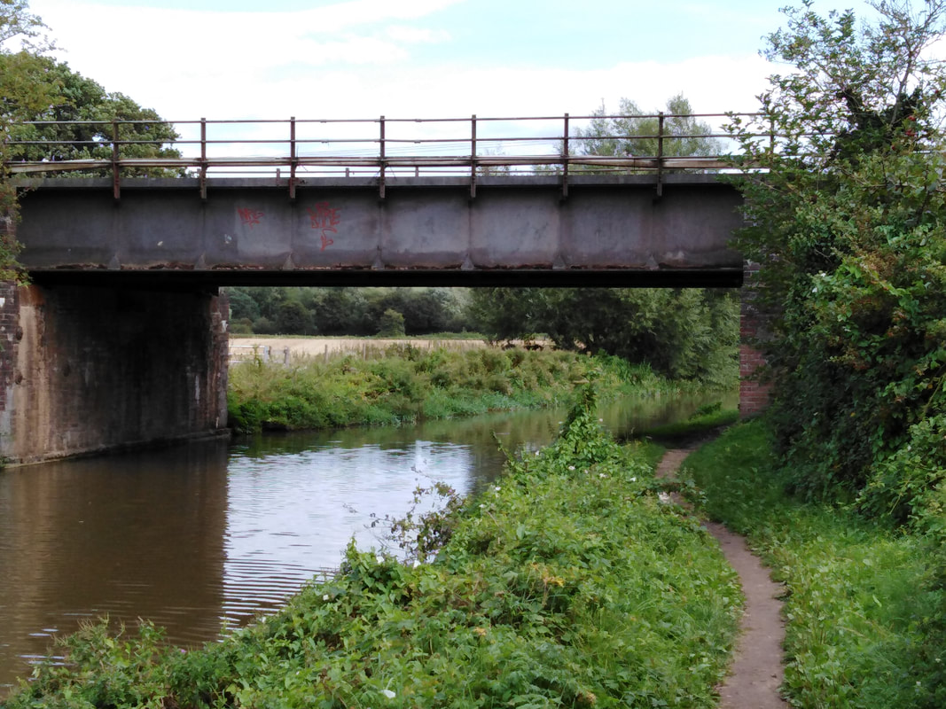
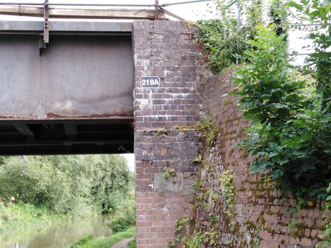
After leaving the lift bridge, we immediately approach the railway bridge (No. 219A) crossing the canal, which carries the Oxford to Birmingham line.

At this point it is worth thinking about the numbering of bridges and locks on the Oxford Canal.
Both bridges and locks have a separate numbering system, with the numbers increasing as the canal proceeds from Coventry to Oxford.
This is very straight forward until there is a change - either adding or demolishing a bridge or lock. In reality, this is more common with bridges, and was especially so with the coming of the railways. To accommodate new bridges into the numbering system, they were given the number of the preceding bridge with an additional A, B, C etc as required. This explains why so many railway bridges have a number ending in a letter. Occasionally, where a bridge has been removed, there is a gap in the number sequence (see later).
This bridge was built in 1850 by the Great Western Railway Company (GWR) as part of the Oxford to Birmingham line. It has a twin plate girder construction with brick abutments and wing walls.
The bridge is noteworthy as being the site of the Shipton on Cherwell train crash of 1874.
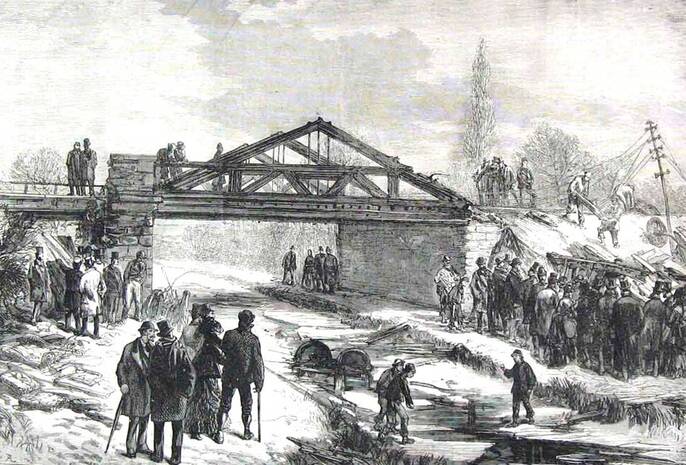
A contemporary newspaper illustration of the Shipton on Cherwell railway crash (1874).
This view from the West shows debris from the shattered rail carriages in the canal and at the bottom of the embankment on the right.
On Christmas Eve 1874, a heavily loaded train carrying about 260 passengers left Oxford station at 11:40, heading for Birmingham Snow Hill. Just before the train crossed a bridge over the river Cherwell, the tyre (outer metal flange) on a carriage wheel failed causing the carriage to come off the rails. It continued to travel upright for a considerable distance, but after the river bridge, the carriage slid down the embankment taking three others with it. They continued across the field, breaking up as they went. The remainder of the train continued on, and then one carriage left the tracks and plunged into the icy waters of the Oxford canal.
Men from the nearby Hampton Gay paper mill helped the injured in the snowy fields, and telegrams were sent to summon help, but it was an hour and a half before a doctor arrived.
It is alleged that the occupants of nearby Hampton Gay Manor refused to offer help or shelter to the victims, and this led to a curse on the house and the subsequent fire which destroyed it.
A special train was used to transport the injured back to Oxford and the dead were moved to a temporary morgue housed in a paper store at the Hampton Gay paper mill.
An inquest was opened on 26 December at Hampton Gay Manor, but was adjourned until the following week when it re-convened in Oxford.
In all there were 34 dead and 69 seriously injured. Of the dead, only one was buried locally. The grave of Benjamin Taylor, a nineteen year old from Wolverhampton, can still be seen in the churchyard of St. Giles church at Hampton Gay.
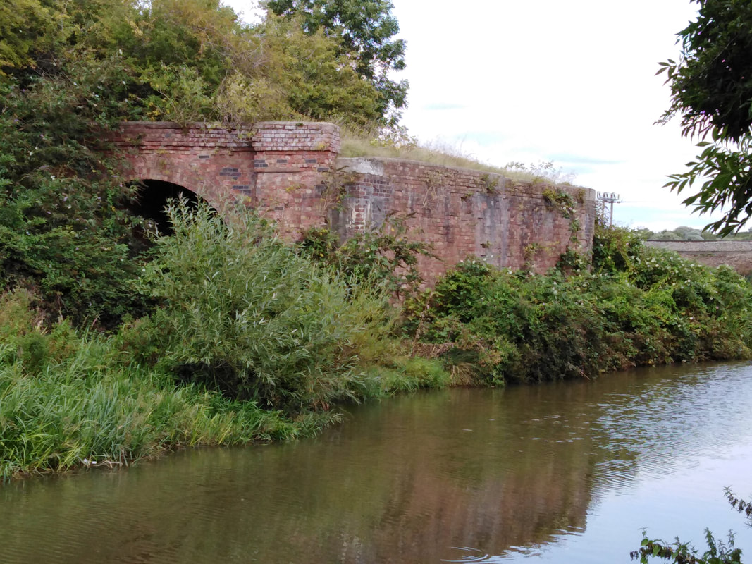
A few yards beyond the railway bridge are the remains of a further railway bridge (presumably this would have been numbered 219B). All that is visible now are the abutments on either side of the canal and the associated embankments.
These are the remains of a bridge which carried the short lived Blenheim and Woodstock branch line. It opened in 1890 and ran from Kidlington station to central Woodstock, with a halt added in 1929 at Shipton-on-Cherwell to serve the Oxford and Shipton Cement Company quarry and works.
The line was closed in 1954 and the line lifted in 1958. Much of the route of the line is still visible until it enters Woodstock.
The canal now approaches the small village of Shipton-on-Cherwell. On the far side, the gardens run down to the canal side, many with canal side moorings.
On the near side are occasional views through the hedging to the river Cherwell and its low lying flood plain.
We now come to a feature which is unique in this section of the canal. Just before the next bridge is what appears at first sight to be an isolated lock gate. This is in-fact a "stop-gate" and can be closed to isolate a section of the canal for repair or maintenance.
It can also be used to protect the canal from flooding, which may well be the use here, given the canals proximity to the river.
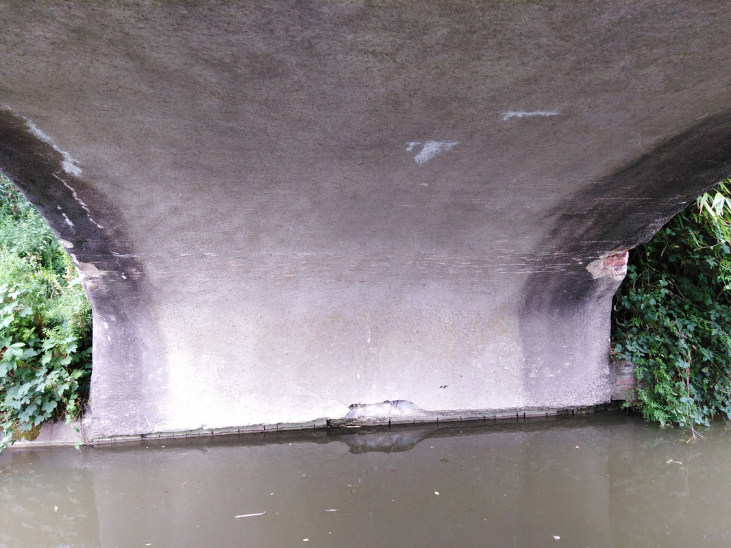
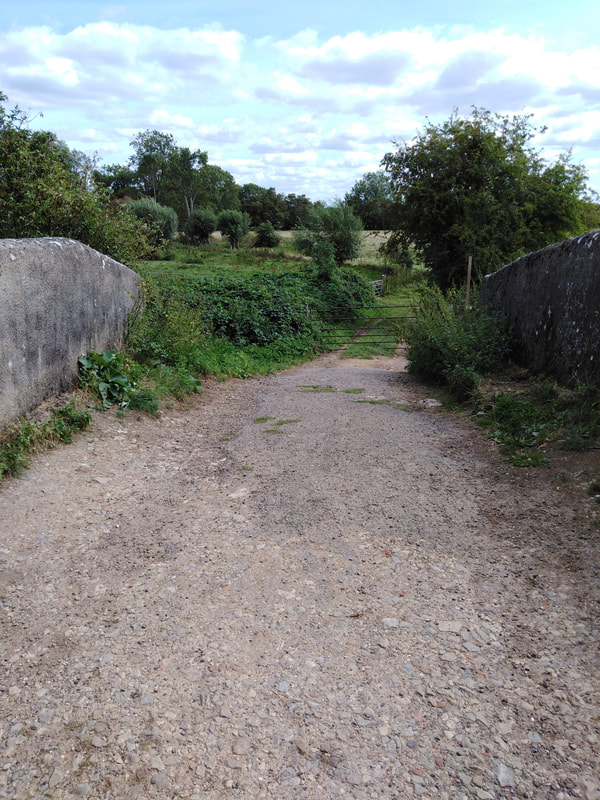
Now we come to the first classic "Brindley" bridge in this section, Shipton bridge (No. 220).
These original bridges were usually made from locally sourced stone or brick, and had a simplicity of form which, as well as having an elegant appearance were highly functional and robust.
These original bridges were usually made from locally sourced stone or brick, and had a simplicity of form which, as well as having an elegant appearance were highly functional and robust.
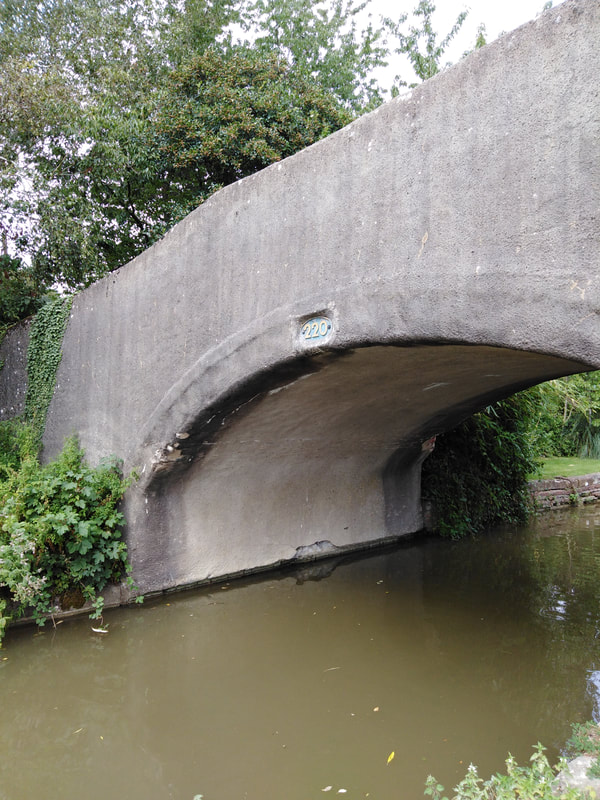
This example is slightly unusual in that it is fully rendered, hiding the underlying construction.
As with most of these bridges it has a centrally placed number plate on both sides of the span.
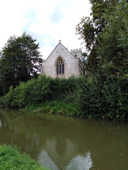
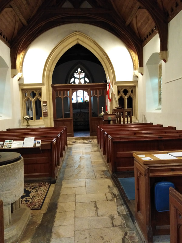
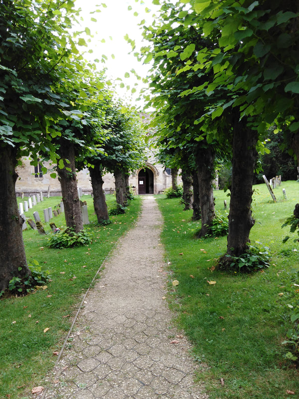
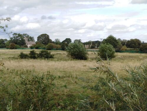
Just beyond the bridge, sitting on a bluff above the off-side of the canal sits the church of Holy Cross.
This attractive and historically important church is well worth spending a little time to visit.
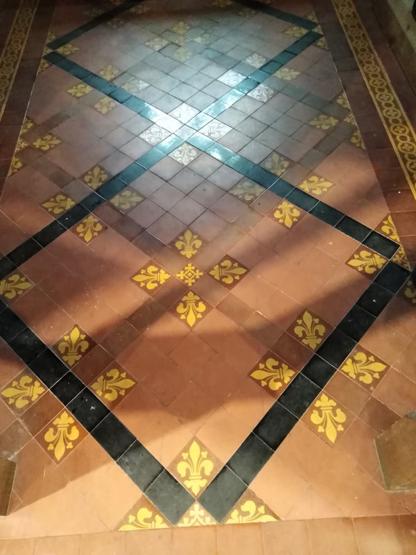
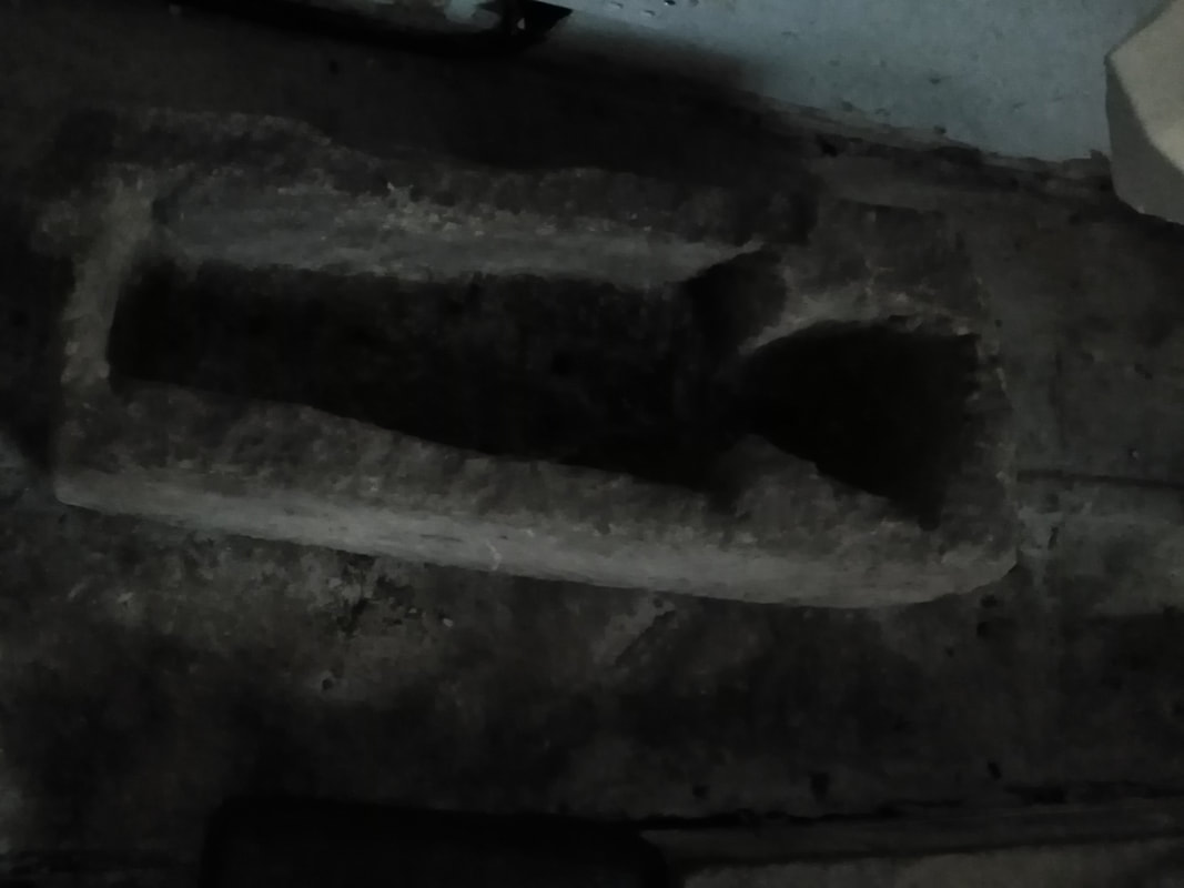
Highlights of its architectural legacy include an 11th century font (reset on a later base), a chancel with 19th century Minton floor tiles, a medieval child's coffin, and a beautifully proportioned nave.
Outside is a tree lined path leading to an entrance porch and the churchyard contains a 14/15th century cross set on a plinth.
The church and cross are both Grade II listed and the churchyard is scheduled.
|
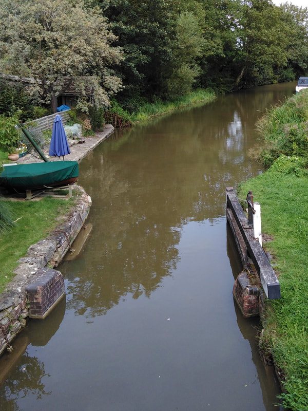
Returning to the canal, we are now approaching Thrupp Wide, with mooring for narrowboats on both sides of the canal. This is an important site for boat replenishment and mooring, as well as being one of a limited number of locations where the canal is wide enough for boats to wind (turn). The river Cherwell now approaches the canal very closely, and is only separated by the width of the towpath embankment. Looking down on the river, the relative change in height of the river compared to the canal since the Shipton Weir Lock becomes apparent. The river has in fact dropped by about 16 feet, but the canal height is unchanged. At this point there is an overflow weir and a draining sluice between the canal and the river. The overflow weir allows excess water to escape from the canal into the river, which is important in particularly wet weather. The draining sluice can be opened to completely drain a section of the canal when serious repair work is needed. |
From here, looking north-east across the Cherwell, are views of the hamlet of Hampton Gay along with the isolated church of St. Giles and the remains of Hampton Gay Manor.Hidden in the woodland beyond are the ruins of the paper mill. All these locations had a role to play in the Shipton-on-Cherwell rail crash (see above)
Hampton Gay contains a significant collection of listed buildings, which include:
- St Giles Church (Grade II*).
- The churchyard wall (Grade II) - 17th century limestone wall and ditch.
- The ruins of Hampton Gay Manor (Grade II) - Elizabethan manor house which burnt down in 1887.
- Manor Farm, barn and gate posts (all Grade II)
- The area immediately surrounding these buildings is scheduled (Hampton Gay deserted village)
This brings us to the end of this section of the canal.
In the next part of our journey, we will look at the canal and its features, as it passes through Thrupp and on to Langford Wharf.
In the next part of our journey, we will look at the canal and its features, as it passes through Thrupp and on to Langford Wharf.
Acknowledgements
Map of Shipton Weir Lock: Based on 25 inch to the mile OS map Surveyed 1919, Published 1922. Reproduced with the permission of the NLS under the terms of the Creative Commons Attribution_Non Commercial_ShareAlike4.0 International (CC-BY-NC-SA) licence
Shipton Weir Lock Keepers Cottage Image: tomato.to
Shipton on Cherwell railway crash (1874): Wikipedia https:/en.wikipedia.org>wiki>Shipton-on-Cherwell_train_crash (Under Creative Commons Licence)
All other photographs: by author (Tony Prothero)
Sources
Oxford Canal Conservation Area Appraisal (October 2012): www.cherwell.gov.uk>info>heritage-evidence
The National Heritage List for England (NHLE): historicengland.org.uk>listing>the list
Location Maps: google.com/maps
Waterways Gazetteer for the Oxford Canal: canalplan.org/waterway/humh
Canal and Rivers Trust: canalrivertrust.org/enjoy-the-waterways/canal-and-river-network/oxford-canal
25 inch to the mile OS maps (1841-1952): maps.nls.uk>os>25inch-england-and-wales
General information: en.wikipedia.org
Archive of early canal maps: canalmaps.net
The railway and canal historical society- A wide variety of information on canal and railway history: rchs.org.uk
Wheels to Disaster! The Oxford Train Wreck of 1874: Peter R Lewis and Alistair Nisbet, The History Press 2009
English Canals Explained: Stan Yorke, Countryside Books 2017
