Definitions of archaeology abound. Collins Dictionary says that archaeology is the study of the societies and peoples of the past by examining the remains of their buildings, tools and other objects.[1] Other definitions refers to ‘artefacts, inscriptions, monuments and other remains…’[2] With this broad definition in mind, it is interesting to look in more detail at some of the features associated with bridges located on the Oxford Canal between Kidlington and Thrupp.
The first of these features are Mooring Rings. Whilst there are many modern mooring rings and many canal cruisers putting them to good use, horses and mules towing barges on the canal would need to have been tied up at times.
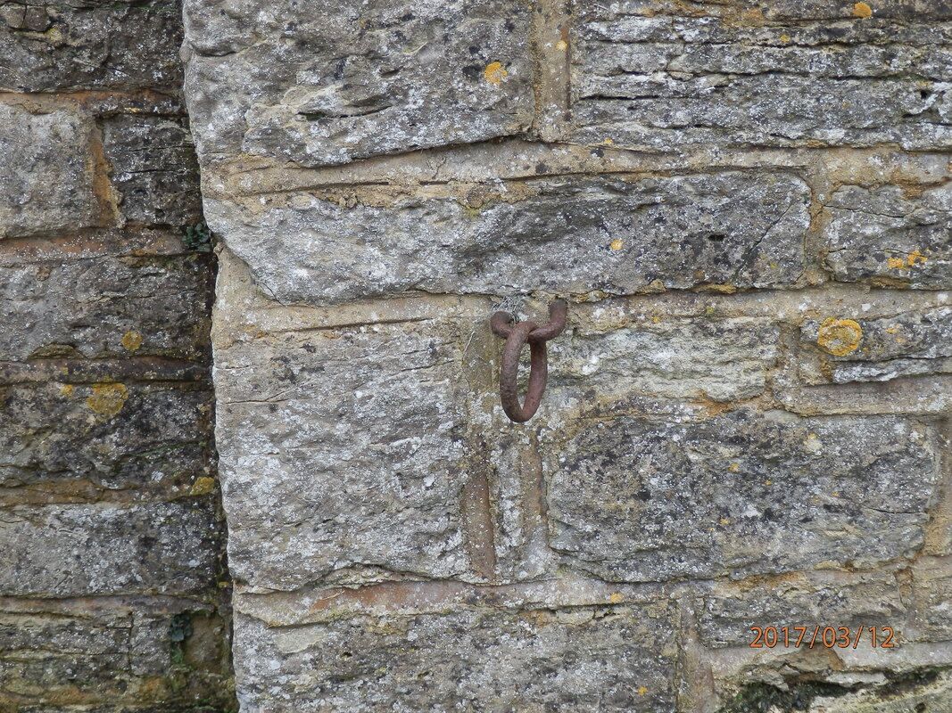
What appears to be an older mooring ring can be found embedded in one of the pillars of Sparrow Gap bridge (Bridge number 223). Whilst the date of origin is unknown it is interesting to think about how this ring might have been used. With the ring located on the pillar, any rope from a canal barge would have stretched somewhat dangerously across the tow path. So – perhaps any horse or mule resting from towing would have been tied up to it whilst standing on what is now the sloping edge of the bridge. Does anyone have any photographs to help with this idea? Do please share with us.
With horse and mule-drawn barges and narrowboats still in mind, tow-ropes would no doubt have dragged in the water of the canal and along the tow path. Some canal bridges have a vertical iron roller or stone rubbing block on the canal-side facings. These are known as Rubbing Strakes. They were designed to prevent wet and grit-laden tow ropes wearing grooves on the corners of bridge arches. None have been found on this stretch of the canal so far. The Monkland Canal castle street bridge in Glasgow references an example. [3] Definitely one to look out for elsewhere on the Canal. Have you seen one?
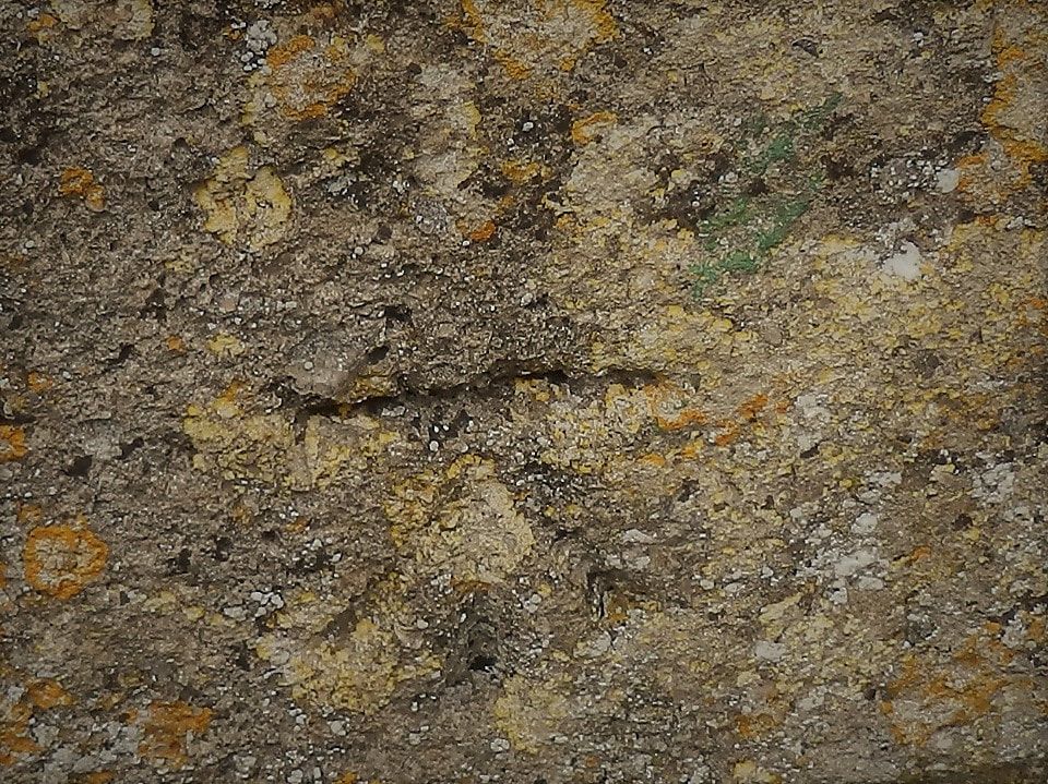
Close examination of Sparrow Gap Bridge revealed a carved mark in the stone. After some research, this is a Cut Mark – an example of the symbols and devices used for map-making across the UK before GPS was available.
Carvings such as this one, or metal plates, were used to calculate distances and heights from each other[4]. Once you have spotted one, you find them in all sorts of places – expand your search beyond the Canal. Be sure to differentiate any Cut Marks from Mason’s Marks [5]
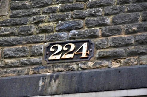
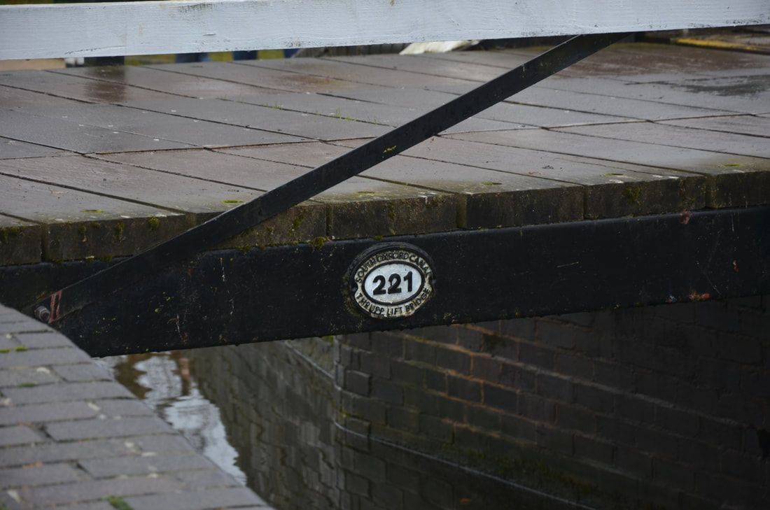
Bridge Number Plates are highly visible along the Oxford Canal and it seems there is little research reported about them. Made of cast iron, generally with white numbering, this style is common on the Oxford Canal. The photograph of the 1930’s road bridge 224 is typical. Bridge 221, Aubrey’s Lift Bridge, has a more rounded shape. Look out for Canal Bridge Number Plates that differ from the norm, and let’s record them.
|
|
[1] https://www.collinsdictionary.com/dictionary/english/archaeology
[2] www.dictionary.com/browse/archaeology
[3] https://canmore.org.uk/site/208991/monkland-canal-castle-street-bridge-glasgow
[4] http://www.heritageandhistory.com
[5] https://warwick.ac.uk/fac/arts/arthistory/staff/ja/research/masonsmarks/
