With the recent limitations we have all experienced due to the Covid pandemic, we've all had to look at life in a different way. Many of the things we took for granted have either been impossible (from haircuts to holidays), or different (shopping in masks, meetings on Zoom or working from home).
For those of us interested in archaeology, we have essentially “lost” a year of field work (the digs and meetings), but some aspects of field walking and landscape investigation has carried on (as long as it conforms to the accepted boundaries of social distancing and travel restrictions).
This “local” limitation of activities got me thinking about how local I could make things; and that took me to my back garden.
Like most people who are gardeners, I have often dug up the occasional piece of broken pottery, rusty nail and yesterdays rubbish. Mostly, this has gone in the bin, but over the years I have kept a few of the more interesting pieces that I think help to tell the story of this little piece of Oxfordshire. So now seems a good time to tell the story of my garden – based on the evidence of the garden “finds” and any documentary evidence that’s available.
My garden sits within the southern part of Kidlington, only a hundred metres or so from its boundary with Gosford, and about 400 m. from the River Cherwell. At only one or two metres above the river level (well within the flood plain [1]), flooding has always been a potential threat; but following the disastrous Easter flood of 1998, a flood protection wall was built in 2000.
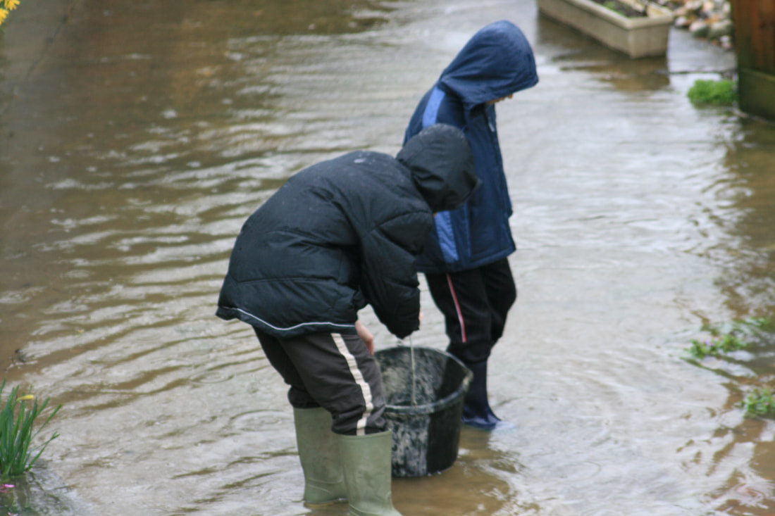
The consequences of building on a flood plain.
Where have all the Goldfish gone?
This historically frequent flooding, allied with a fertile soil (alluvium sitting on underlying Oxford Clay [2]), would have significantly influenced the way the land was used in the past. Early farmers progressively cleared the “Wild Wood” and opened up the land for cultivation. Much of the Cherwell valley would have been under cultivation by the Anglo-Saxon period (410-1066). Progressively more sophisticated farming technology, especially the introduction of the heavy plough pulled by oxen teams, allowed large areas of heavier soil to be cultivated, eventually leading to the development of the open field “ridge and furrow” landscape. Lower lying land along rivers was often not ploughed but used as pasturing for livestock, or as meadowland for haymaking. [3]
The overall layout of the landscape remained relatively unchanged until the early 19th century and the advent of enclosures. The Kidlington Inclosure Act of 1818 resulted in the wholescale restructuring of the land. Open fields and ridge and furrow farming gave way to smaller, regular, enclosed fields with standardised boundaries; the typical thorn hedges that we are so familiar with today. These radical changes swept away a thousand years of rural tradition, often to the detriment of the working poor, with the wealthier classes gaining ownership of most of the land. [3]
Until the 1950s this part of Kidlington remained as agricultural land, primarily used for pastoral farming. Further north there had been large orchards which bordered the roads almost to the centre of the old village, in many of which apricots were grown (historically Kidlington had been famous for apricot growing and sent “thousands of dozens” of apricots to Covent Garden in the 1830s). Growth of the village saw these orchards slowly being swallowed up by residential building, along with extensive ribbon development along the length of the Oxford/Banbury Road. [3]
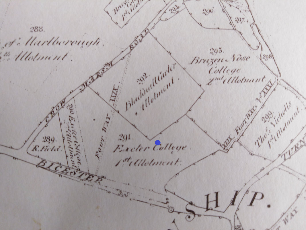
1818 Enclosure map [4]: The historical open fields were divided up and "enclosed" by hedging. The future site of my garden (Blue dot) sits within land granted to Exeter College (291) and near that of Carter Blacknall (292). The future Evans Lane was known as Crow Marsh Road. The junction of Bicester Road and Water Eaton Lane can be seen bottom right, with the turnpike road towards Bicester heading off from the junction in a north- easterly direction.
1919: Most of the southern part of Kidlington retains its open rural character. Further north, extensive apricot orchards extend almost into the village centre. [5]
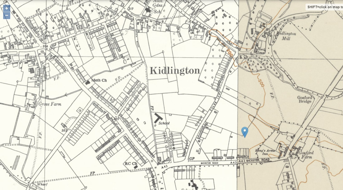
1955: The growth of Kidlington is evident with building along the Oxford Road, Bicester Road and Evans Lane. The once extensive orchards have shrunk considerably in area. Soon they will exist only in memory. [5]
During the mid-part of the 1950s, development continued unabated, with large scale residential building in the Cherwell Avenue/Queens Avenue area, running right up to the River Cherwell. This development was then extended in the later part of the 1950s (the then titled Springfield Estate), and this is where I live.

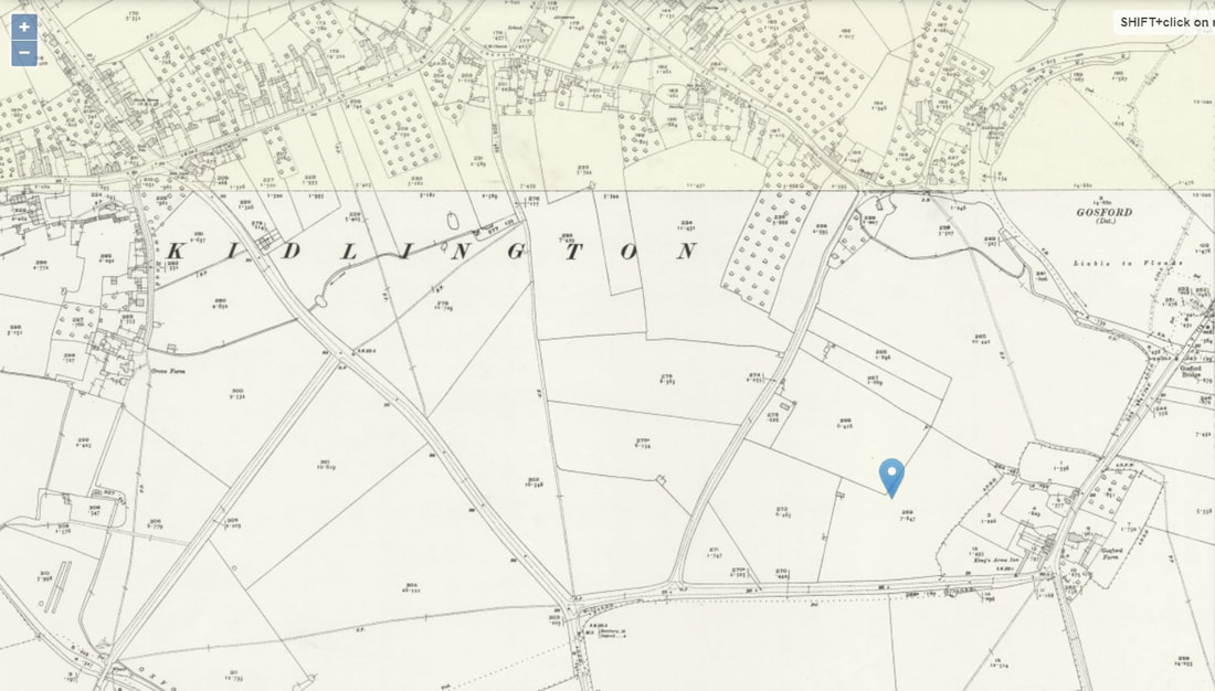
2020: Virtually all the open land north of Bicester Road has disappeared under new building.
The house itself is typical of its era; brick built with exterior rendering, originally three bedrooms (now four as the family expanded!), front and rear gardens. The back garden has an unusual shape, which goes “round the corner”. This is a result of the original layout of the building plots, which left an unused piece of land enclosed by housing. Local lore has it, that this plot was originally intended to be either another residential road or a school (both seem unlikely given the limited land area). However, the eventual outcome was that this land was sold off piecemeal as garden extensions, thus resulting in some long or oddly shaped garden plots.
All that grows …
Looking at maps and aerial photography of the site from before the development, this layout may have followed some of the original field hedge alignments. Towards the bottom of my garden, part of the boundary if formed by a large hedge; so large and overgrown in fact, that when we moved in, it was at least a year before we realised that there was a path hidden away beneath it. The hedge is essentially Hawthorn, but over the years has become dominated by ivy, with a bit of beech and several species of wildflowers. The possibility that this is a remnant of the original field boundary seems likely.
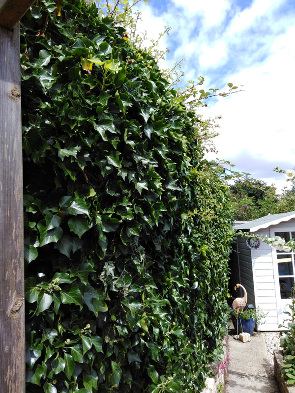
The large Hawthorn hedge that forms part of the garden boundary.
Although now dominated by ivy, it contains several native species.
Close scrutiny of old maps and photos suggest that the present hedge and the original field hedge almost coincide, but not quite, the difference being 2.7 metres. However, there does appear be a misalignment between the older mapping and modern versions. Using a known fixed point which appears on the old maps/aerial photos, and modern imagery/maps, the amount of offset can be measured. In this case I used the corner of a local pub building, and the mismatch is about 2.6 metres.
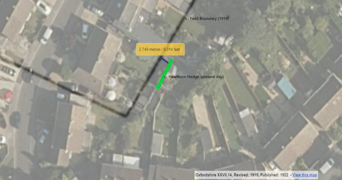
Detail from 1919 map overlying modern imagery. The garden hedge runs parallel to the field boundary shown on the 1919 map with an offset of 2.7 metres.
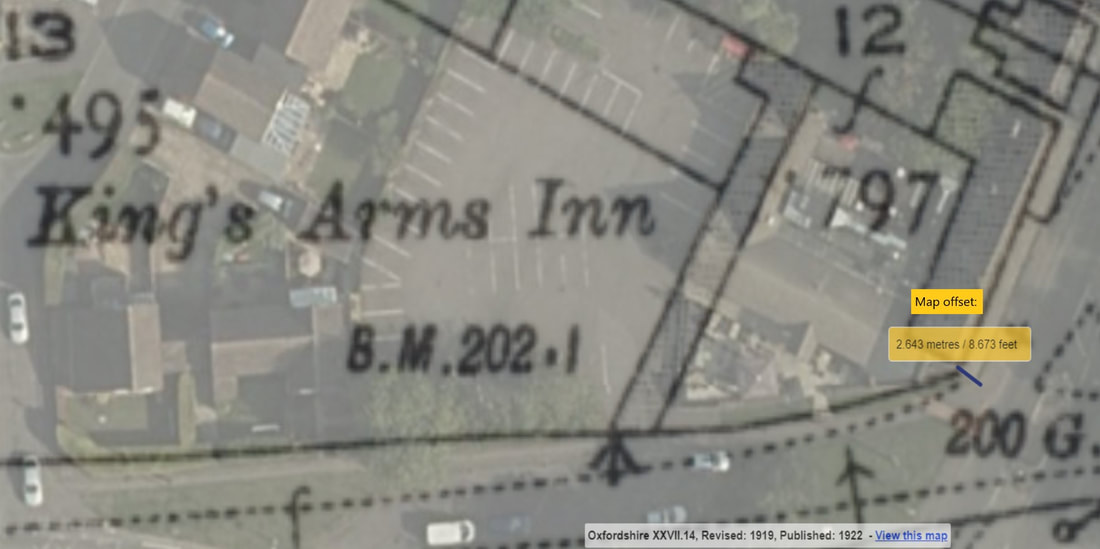
Comparison of the 1919 map and modern imagery shows a positional discrepancy of 2.6 metres.
Using this adjustment, it would seem very likely that the hedge at the bottom of my garden is a remnant of the original inclosure field boundary, absorbed into today’s urban layout. I suspect that this is not an unusual occurrence, and that many older features and alignments are hidden within modern surroundings, waiting to be recognised.
Estimating the age of old hedgerows can be difficult. The appearance, layout and old maps can all give clues as to their origin. The oldest hedgerows can date back to Anglo-Saxon times and will often have survived because they form part of important boundaries, such as those of parishes or estates. These will often have irregular or sinuous courses, sometimes following natural features such as streams or breaks in slope and may incorporate “veteran” trees. More modern hedgerows tend to have regular layouts, especially if they were planted as part of the inclosures of the 17th and 18th century. The Hooper formula uses the diversity of species growing within a hedgerow to estimate its age [6]. The number of trees or shrubs growing in a 30 metre length of hedge multiplied by 100 will give an approximate age: so a single species hedge is likely to be less than 100 years old, but a hedge with greater than 10 species may well be 1000 years old. This can only ever be a rough guide, and is fraught with potential errors, but can be useful in assessing the relative age of hedges in a particular area.
The grass is greener (or not) …
During the spring and early summer of 2018, we basked in exceptionally warm and dry conditions. This led to increasingly challenging conditions for farmers and growers, with many crops and flowers failing to develop. These harsh growing conditions, however, proved to be a boon for archaeologists, with the development of so-called cropmarks [7] (also known as parch marks). These are areas where the growth of plants is “stressed” by difficult growing conditions and show up as either positive features (greater growth) or negative features (lesser growth). During the drier summer months, these tend to be positive on deeper soils (over ditches and pits etc) and negative on shallow soil (over walls, stonework, roadways etc).
In my garden, as the grassed areas became increasingly scorched, an interesting pattern began to emerge, which clearly showed two straight features which were the outline of an old building. About 20 years ago, a garage which had stood in the back garden, had been demolished. The hard standing had been broken-up and removed, the walls taken out to foundation level, and the area backfilled and turfed. Now the positions of the buried wall foundations were being revealed by parch marks.
Parch marks revealing the position of buried wall foundations.
This was to be a common occurrence during this unusually long dry spell, especially in the more southern and eastern parts of the UK, and several new and important archaeological sites were identified that year. The development of parch/crop marks is not only dependent on weather conditions, but also on soil type. It is far more commonly seen on lighter, better drained soils.
In 2020, we also experienced a long, dry, and at times warm spring; just as we were beginning to get to grips with the Covid lock-down. Again, this affected the growth of plants in our gardens, but in a slightly different way to that seen in 2018. Particular plants have their own particular preferences as to optimum growing conditions. This will include the amount of shade or sunlight they receive, and the acidity, chemical composition, compactness, and wetness or dryness of the soil they are growing in (amongst many other factors).
Two familiar plants that grow in our garden lawns and in grassland pastures are buttercups and daisies. There are several varieties of both, but each group tends to need broadly similar growing conditions. Daisies, as a rule, are more tolerant of dry conditions, whereas buttercups tend to prefer wetter environments. As the dry spring progressed, buttercups tended to grow in areas that were either lower lying and naturally wetter, or where the soil composition/depth held moisture better.
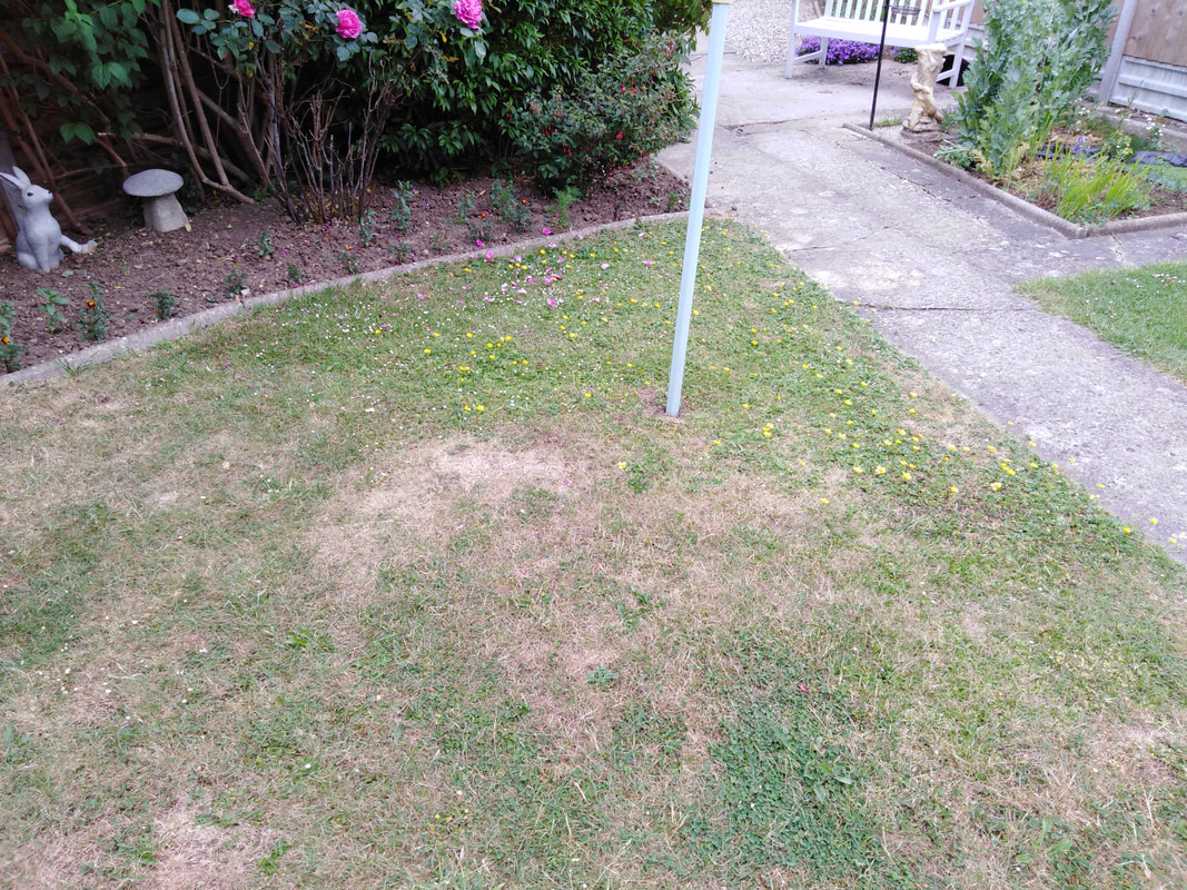
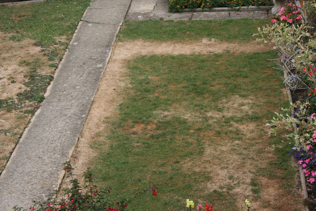
After a dry spring the grass in the foreground is becoming scorched. Beyond the line-post, the area in the corner shows not greener growth but has far more buttercups growing. This would suggest a more moisture retentive or deeper soil.
Over the years there have been lots of changes to our garden, one of them being to extend the grassed area into what had been an extensive flower bed. This new area of grass probably had soil with more organic content and thus held moisture better than the rest of the grass. The consequence of that was that the buttercups tended to grow better in this area. This is yet another example of how we can use plant growth to tell us something about the soil and underground features that are out of sight. A nice example of this can be seen in St Mary’s Fields in late spring/early summer if the conditions are right. This area of nicely preserved ridge and furrow is treated as a hay meadow and remains ungrazed and uncut through the spring and early summer. The wetter furrows tend to show more buttercup growth and the drier ridges having more daisies.
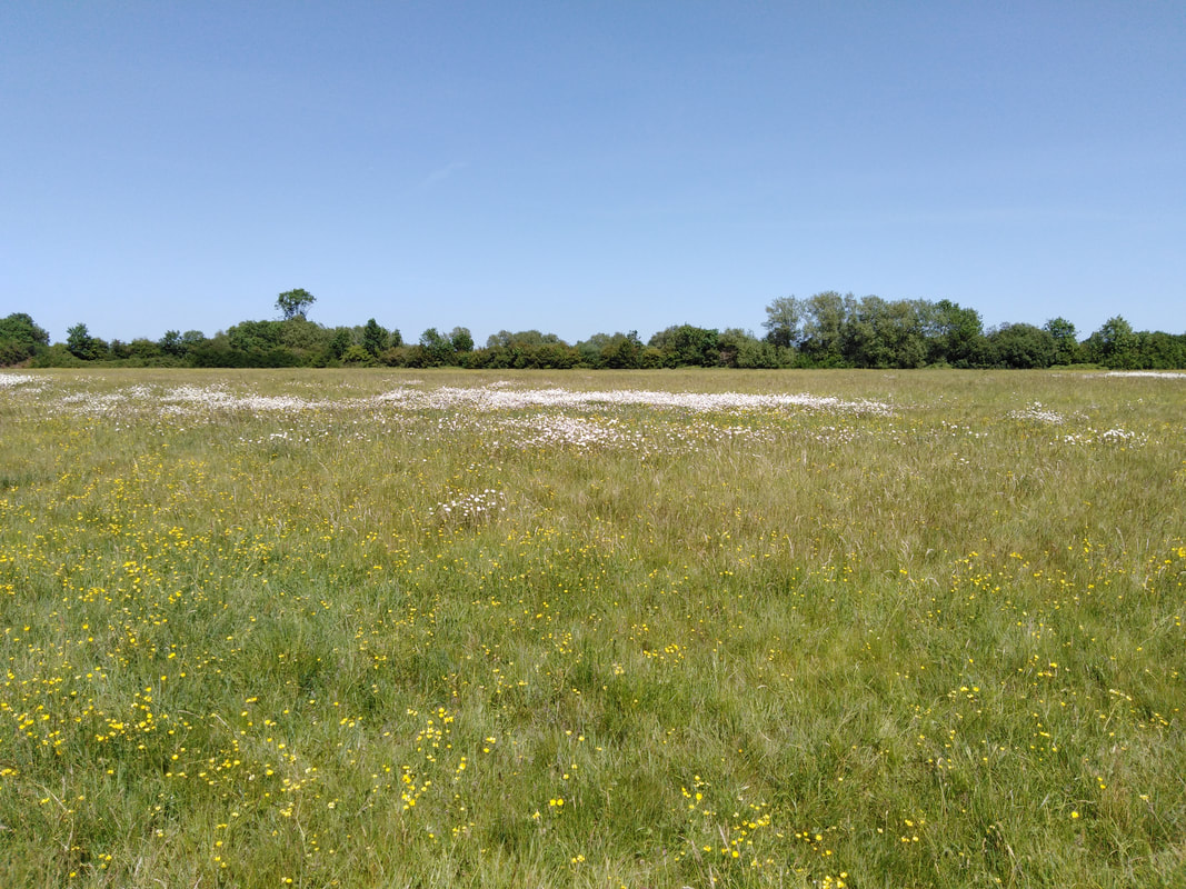
St. Mary's Fields in late spring.
In the foreground, buttercups thrive in the wetter conditions of the "furrow". Beyond, on the drier "ridge", daisies dominate. The sequence is repeated beyond, resulting in a floral stripped pattern.
Such “floral signs” are all around us; poppies tend to grow best on disturbed or cultivated ground (thus their tragic association with the ravaged landscape of the Western front during WW1), whilst nettles prefer soils with a high nutrient content (often seen around farms where the waste from livestock enriches the soil). Willows almost inevitably reveal the location of damp ground, and commonly mark the location of rivers and streams.
We dig, dig, dig ….
Now we get down to “real” archaeology, because that’s all about digging holes in the ground … isn’t it? Funnily enough, that’s also what a lot of gardening is about as well, and that is what we will look at next – not the digging itself, but what you can find when doing it.
To start with, we need to think about the soil itself. Soil is remarkably complicated stuff; mixture of organic material (humus), mineral content (essentially ground down rocks) and soil organisms. Generally speaking, the greater the proportion of humus, the darker and more fertile the soil is, along with a greater capacity to hold its moisture content. The chemical composition of the soil will often determine not only the type of plants that it will support (many plants will prefer either a more acid or alkaline soil), but also the types of artefact that will survive when buried in it. Bone tends to survive best in alkaline, wet conditions whereas metalwork preservation is most likely in alkaline but dry soil. Waterlogged soils favour the survival of organic material such as wood, leather and cloth.
If we pick up rubbish from the ground, we call it litter picking and moan about the people who dropped it, but if we dig up rubbish from long ago, we call it archaeology and are pleased to have the opportunity to do so. So, the “finds” we make in our gardens are essentially, either old rubbish that was carelessly thrown away, items lost by mischance, or things deliberately placed there for a reason (the reason may not be obvious to us!).
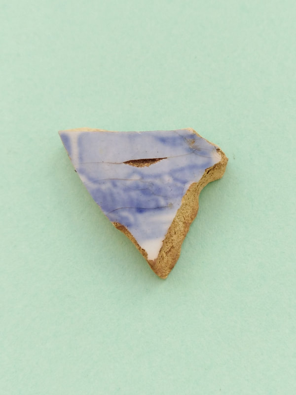
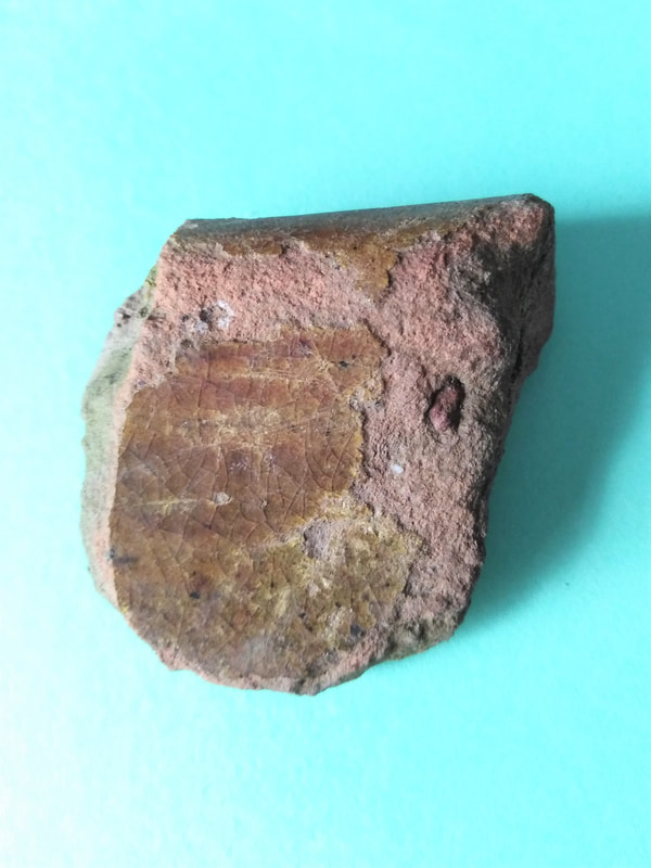
Probably the most common object found when digging is a piece of broken pottery [8]. Blue and white ware (willow pattern amongst others) or plain white glazed ceramic is typical and can be difficult to date (willow pattern tableware has been produced in Britain from the late 1700s until the present day). An older, but not uncommon find is glazed red earthenware. This was produced from the mid-1500s until the 1800s and usually has an almost brick-red fabric with a shiny orange, green or clear glaze on the inner surface (also sometimes on the outside surface). Where the glaze has worn off, these shards can look remarkably like modern flowerpots. This type of pottery was typically used to make large cooking pots and cauldrons.
We dig, dig, dig ….
Now we get down to “real” archaeology, because that’s all about digging holes in the ground … isn’t it? Funnily enough, that’s also what a lot of gardening is about as well, and that is what we will look at next – not the digging itself, but what you can find when doing it.
To start with, we need to think about the soil itself. Soil is remarkably complicated stuff; mixture of organic material (humus), mineral content (essentially ground down rocks) and soil organisms. Generally speaking, the greater the proportion of humus, the darker and more fertile the soil is, along with a greater capacity to hold its moisture content. The chemical composition of the soil will often determine not only the type of plants that it will support (many plants will prefer either a more acid or alkaline soil), but also the types of artefact that will survive when buried in it. Bone tends to survive best in alkaline, wet conditions whereas metalwork preservation is most likely in alkaline but dry soil. Waterlogged soils favour the survival of organic material such as wood, leather and cloth.
If we pick up rubbish from the ground, we call it litter picking and moan about the people who dropped it, but if we dig up rubbish from long ago, we call it archaeology and are pleased to have the opportunity to do so. So, the “finds” we make in our gardens are essentially, either old rubbish that was carelessly thrown away, items lost by mischance, or things deliberately placed there for a reason (the reason may not be obvious to us!).
Probably the most common object found when digging is a piece of broken pottery [8]. Blue and white ware (willow pattern amongst others) or plain white glazed ceramic is typical and can be difficult to date (willow pattern tableware has been produced in Britain from the late 1700s until the present day). An older, but not uncommon find is glazed red earthenware. This was produced from the mid-1500s until the 1800s and usually has an almost brick-red fabric with a shiny orange, green or clear glaze on the inner surface (also sometimes on the outside surface). Where the glaze has worn off, these shards can look remarkably like modern flowerpots. This type of pottery was typically used to make large cooking pots and cauldrons.
|
|
Blue and white ware Cream ware (possibly the rim of a plate or saucer)
|
|
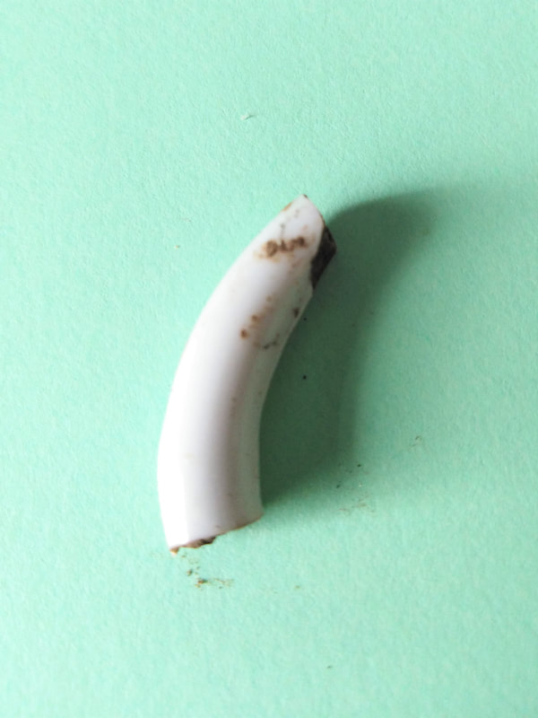
High glaze white ware (teacup handle) Glazed red earthenware
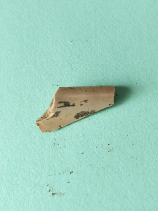
Other typical finds are the white or cream coloured fragments of clay tobacco pipes, which were the cigarettes of their day, and manufactured and discarded in their millions. If you dig a hole anywhere in Oxfordshire that has had human occupation for more than 150 years, the chances are that you will find one of these. Because they are extremely common, and because their appearance changed rapidly, clay pipe fragments can be very helpful for dating sites [9]. Not only did the styles change with time, they tended to have regional variations (especially the older types) and so they can used to trace the movement of people and manufactured goods. Older clay pipes tend to have smaller bowl sizes, be made of coarser clay and have larger stem bore sizes. Later pipe bowls became larger with more intricate ornamentation (as the price of tobacco dropped) and the stems became thinner and longer with a smaller bore size. Some archaeological sites, especially those in larger towns and cities, can produce literally thousands of clay pipe fragments.
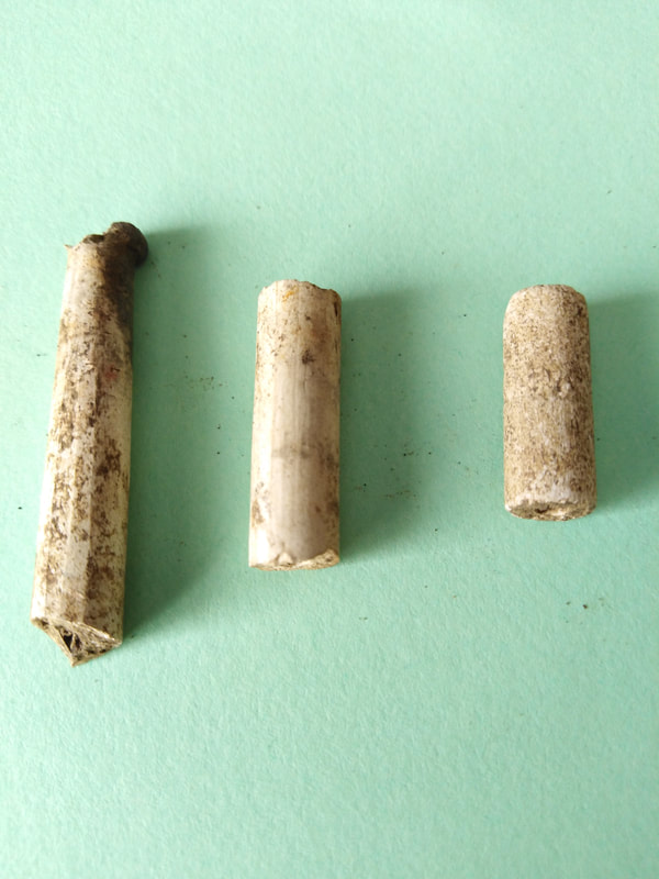
Clay tobacco pipe fragments.
Left: stem-end with shaped mouthpiece.
Middle: typical 19th century stem fragment. Made from fine white clay with a smooth finish.
Right: similar sized stem fragment, but made from coarser greyer clay and with not so fine a finish. This may be earlier in date or manufactured using local rather than imported clay.
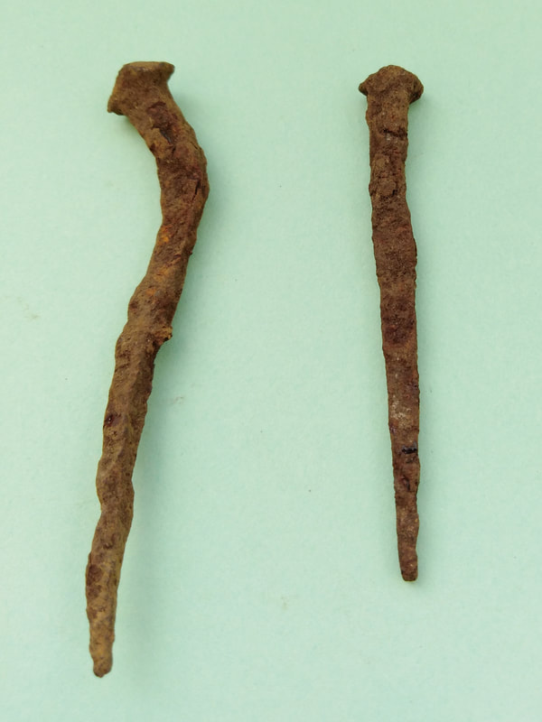
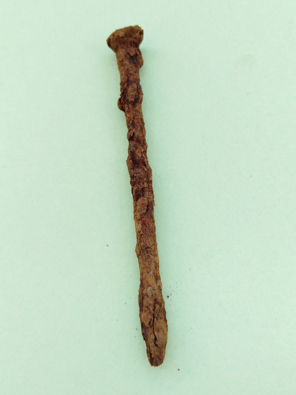
Metalwork is a frequent find, mostly significantly corroded, but quite often still identifiable. Nails are commonly found, these seemingly mundane objects providing useful dating information [10]. Nails have been produced by hand for thousands of years, the Romans produced wrought iron (hand made by a smith) nails in industrial quantities. It wasn’t until the 1600s that machines started to replace some of the blacksmith’s roles, but they still produced essentially the same product; a square nail that tapered to a point on all four sides with a square(ish) hammered head.
|
|
Left: Wrought iron nail - square profile, Wire nail: Machine manufactured with a round
tapering in on all four sides (pre 1780s). profile and head. Tapering at end only (1900 onwards)
Right: Cut iron nail - square/rectangular profile,
tapering on two sides only (1780s to ~1900)
tapering in on all four sides (pre 1780s). profile and head. Tapering at end only (1900 onwards)
Right: Cut iron nail - square/rectangular profile,
tapering on two sides only (1780s to ~1900)
In the late 1700s true machine manufacturing began to emerge, producing the so-called “cut nails”, a square nail cut from an iron bar with two tapering sides and a roughly square head. Around 1900, steel wire became widely available, and was soon used to manufacture the ubiquitous round steel nail with a round head that we are familiar with today.
The other major metalwork finds that people are always fascinated with are coins. This fascination is perhaps partly to do with their pecuniary value, but also with the thought that they were either lost by sheer bad luck, or deliberately hidden (either for safety or as a votive offering). Whatever the reason for their being there, finding an old coin, is special. I have only ever found one such coin in the garden, and that is a George VI sixpence (1941), which we came across whilst replacing a fence.
The other major metalwork finds that people are always fascinated with are coins. This fascination is perhaps partly to do with their pecuniary value, but also with the thought that they were either lost by sheer bad luck, or deliberately hidden (either for safety or as a votive offering). Whatever the reason for their being there, finding an old coin, is special. I have only ever found one such coin in the garden, and that is a George VI sixpence (1941), which we came across whilst replacing a fence.

|

|
George VI sixpence (1941): A typical coin find. Assigning a precise date to a site with such a find
would seem simple, but care must be taken! It may not have been dropped/placed for many years
after the mint date, and perhaps not where it is eventually found.
would seem simple, but care must be taken! It may not have been dropped/placed for many years
after the mint date, and perhaps not where it is eventually found.
The coin was from ground directly on the fence line that appeared never to have been dug over, and so the coin is likely to have remained where it was originally dropped. The houses here were built in 1956, and so it is possible that it had lain there since then. There is, of course, the possibility that it was dropped much later; the average lifetime of a pre-decimal coin in circulation was about 40 years. Or it could have been dropped when this area was still open farmland (before 1956).
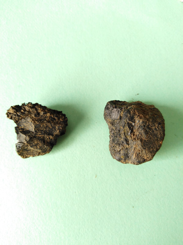
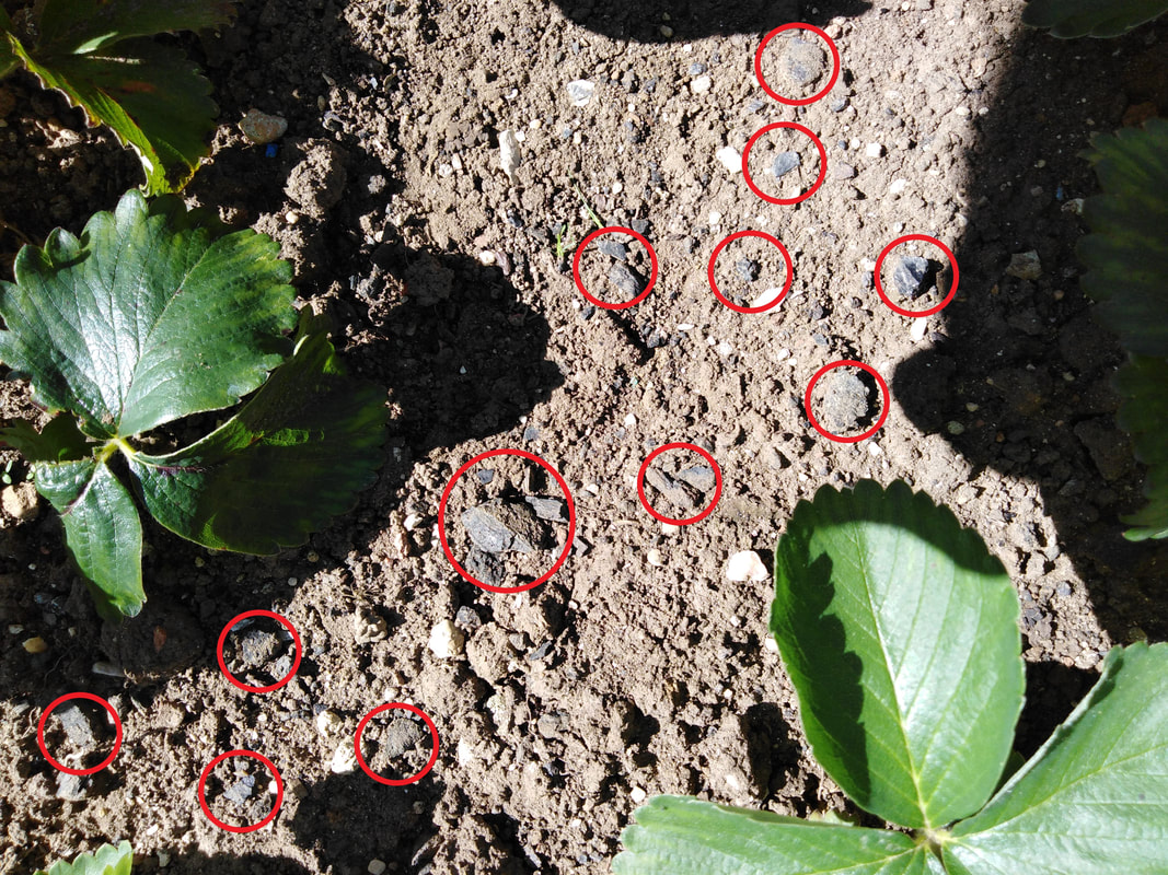
Apart from deliberately manufactured objects, mankind also leaves other evidence of his presence. Throughout the garden, in almost every area that I dig, I find small pieces of coal and cinders. Until the advent of electric and gas heating, coal burning was the most common form of domestic heating, and almost all houses built before the 1970s would have had a coal fire (in 1943 23% of all coal burnt in the UK was used for domestic heating, by 1980 this had dropped to 7%, and by the year 2000 was a mere 3%) [11].
Apart from deliberately manufactured objects, mankind also leaves other evidence of his presence. Throughout the garden, in almost every area that I dig, I find small pieces of coal and cinders. Until the advent of electric and gas heating, coal burning was the most common form of domestic heating, and almost all houses built before the 1970s would have had a coal fire (in 1943 23% of all coal burnt in the UK was used for domestic heating, by 1980 this had dropped to 7%, and by the year 2000 was a mere 3%) [11].
|
|
Coal and domestic hearth waste: an important Coal fragments and burnt hearth waste in garden soil: a single indicator of human occupation and activity. domestic fireplace will produce a large volume of waste.
It was common practice to dispose of the ashes and cinders from the fire in the garden, and this is certainly the case here. In fact, it is surprising how much residue from the domestic fire there is; and this is an important point. On an archaeological dig, the presence of charcoal, cinders or unburnt coal is taken as a marker of probable human occupation or activity. The fact that one domestic fire can produce so much waste material over a period of possibly 30 years, cautions us to be wary of making assumptions about the quantities of such finds.
The final group of finds are those that occur despite human activity – animal, vegetable or mineral.
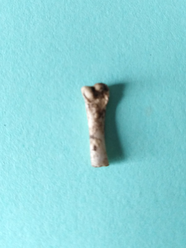
Evidence of animal activity is all around us. Finding small animal bones; birds and mammals or even the occasional carefully interred family pet, is quite common. The possibility of the remains of a Sunday roast or sumptuous Christmas feast appearing in the vegetable patch should also be considered!
The final group of finds are those that occur despite human activity – animal, vegetable or mineral.
Evidence of animal activity is all around us. Finding small animal bones; birds and mammals or even the occasional carefully interred family pet, is quite common. The possibility of the remains of a Sunday roast or sumptuous Christmas feast appearing in the vegetable patch should also be considered!
|
|
Small mammal bone: possibly from a rodent. Large mammal rib fragment: possibly pig.
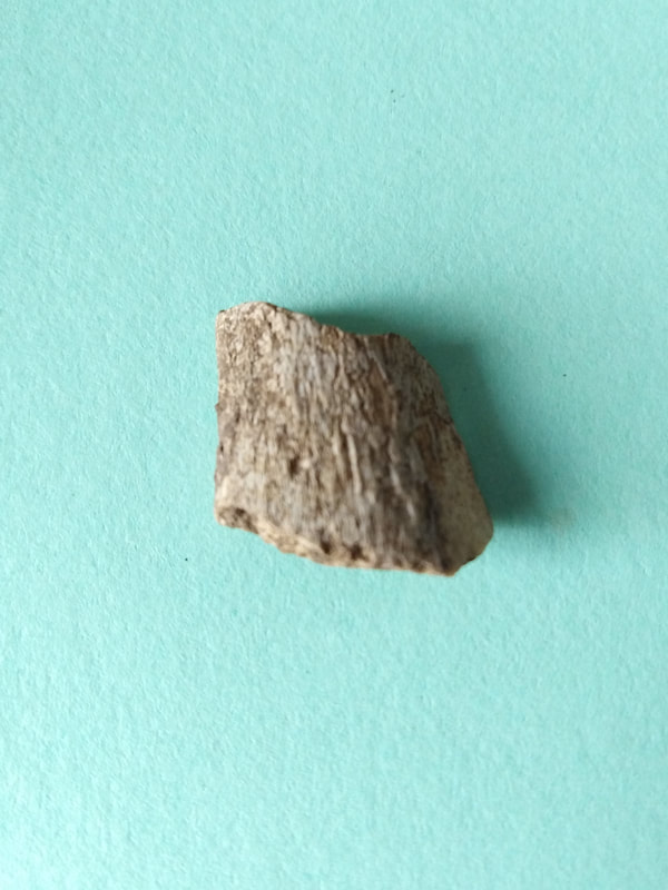
Buried wood can be looked at closely for evidence of carpentry, tool marks or associated fixings and fixtures. The wood itself can be a useful indicator of past environments and burial conditions.
Finally, the mineral content and appearance of the soil can give interesting information about the underlying geology, past environmental events (glaciation, the action of water etc) and past cultivation. There may also be the occasional fossil, in this case a fossilised shell and a small part of the internal “guard” of a belemnite (a creature that looked like a cross between a squid and an ammonite). When found in a complete state, these have the appearance of a long tapering bullet shaped structure, often mineralised and smooth surfaced.
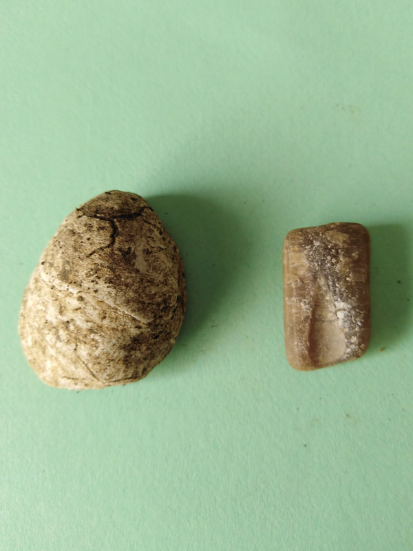
Fossils:
Left - Bivalve shell (much like those that can be found on the beach today.
Right - Part of the internal guard of a Belemnite.
Both creatures would have lived in warm, shallow seas during the Jurassic period.
(201 - 145 million years ago)
This brings us to the end of our Covid era garden exploration. Like many things in life, it’s quite often what you make of an opportunity, however unexpected it may be, that is the important thing. Using the garden as a starting point, we have considered how using documentary evidence and the things we find in the ground can inform (and I hope entertain) us.
We have travelled from the unimaginably distant past of the Jurassic to the recent past of our parent’s times (or even our own childhood), and all within the few square yards of a Kidlington garden.
Some questions are answered, many more are still left to ask!
What can your garden tell you?
Happy digging!
References and Further Reading
[1] Flood map for planning (www.flood-map-for-planning.service.gov.uk) Information about local flooding risk and flood plains.
[2] Geology of Britain Viewer: British Geological Survey (www.bgs.ac.uk) A nice interactive site that allows you to "see" your local geology.
[3] British History Online (www.british-history.ac.uk) An enormous repository of primary and secondary sources.
[4] Kidlington Enclosure Map 1818 (www.kidlingtonhistory.org.uk) Kidlington & District Historical Society - lots of local historical information.
[5] Historical OS maps: Reproduced with the permission of the National Provides access to historical OS maps combined with modern satellite
Library of Scotland (www.maps.nls.uk/index.html) imagery.
[6] Dating of hedgerows (www.historicengland.org.uk) Historic Englands site is an invaluable starting point for all things archaeological as well as historical.
[7] Cropmarks (HistoricEngland.org.uk/cropmarks) Nice explanation along with animation and examples
[8] Pottery identification
(www.meldrethhistory.org.uk/documents/pottery_identification_guide.pdf) An overview of pottery types (prehistoric to modern)
[9] The National Pipe Archive (www.pipearchive.co.uk) Everything you wanted to know about clay pipes and more!
[10] The history of nailmaking (glasgowsteelnail.com/nailmaking.htm) The evolution of nail manufacturing explained.
[11] The death of UK coal (www.ourworldindata.org/death-uk-coal The story of the decline in UK coal usage in numbers.
